
District Wide GIS
GDMS has developed an easy to use web browser based tool to search for and display mapping and asset information, create maps, track and assist maintenance staff, and provide desktop and mobile users the ability to access and share information. The application is server based so only a single server and software installation is required to serve many purposes and users.
Emergency Management
• Evacuation plan/map
• Utility shut-off locations (building and main services)
• Generator types locations & procedures
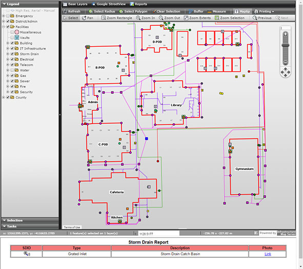
Facilities & Maintenance
• Building & site maps
• Underground utility infrastructure locations and information
• Generator types locations & procedures
• Maintenance locations for sewer cleanout, storm drains, air conditioners, etc.
• Link to work order systems and create a graphical/visual representation
• Historic records and inventory of facilities
• Link to and view as-built plans tied to objects/facilities on the map
• Aid staff and Architect/Engineers with new facilities or modernizations
• Avoid conflicts with existing underground utilities
• Provide inventories of valves, hydrants, air conditioners, etc.
GDMS | 42140 10th Street West, Lancaster, CA 93534 | Phone: (661) 949-1025 | gdms@gdms-1.com